Elevate Your Vision with Ovrsky Drone Services
Capturing stunning aerial photos and videos for real estate, construction, and mapping.
Real Estate
Showcase properties from breathtaking angles.
Highlight every detail with crisp aerial shots.
Make listings stand out in a crowded market.
Construction
Mapping
Meet ovrsky's drone team
Doneil has always had a love of flying. He completed his FAA Part 107 a couple of years ago and has been flying ever since on a daily basis.

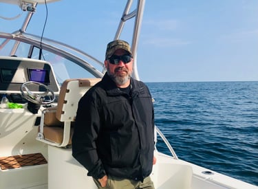
Meet your Pilot
Real Estate and More!
From crisp real estate photos to precise construction maps, our drones bring clarity and perspective to your work.
Our Services
High-quality drone shots for real estate, construction, and mapping.
Real Estate
Capture stunning aerial photos and videos that highlight your property’s best angles.


Construction
Track progress and survey sites safely with detailed aerial construction imagery.
Precise mapping services helping you plan and execute projects efficiently.
Mapping


Stay Updated
Get the latest drone service news and offers